Since One Million Miles is such a long distance I thought it would be nice to have some smaller goals to reach toward in the mean time and enjoy getting to our higher goal that much faster.
So I thought it would be fun to walk across the United States and was told about a website that tracks the mileage from state capital to state capital. So we will not go directly across but just to cross the states doesn’t get us very far mileage wise anyway soooooooo here goes….
We will be starting from Augusta Maine which is where some of my French ancestors settled and we’ll see where this journey takes us. Once we travel around the U.S. walking around to all of the capitals of the United States I thought we would virtually walk around the world. We will see how far we get in One Million Miles. It also depends how many people are willing to donate miles.
I also thought it would be cool to have some pictures from the places we visit. Or some interesting facts. I will be adding these as well as we go along here and there. Anyone else is also able to offer some interesting facts or nice pictures or memories of the places we go if you would like to share them with us.
To start off with we are walking from Augusta Maine (see 2 pictures below)


through NH (see Hampton Beach below).
The beach is one of my all time favorite places to go. I love the feeling of the sand between my toes, the calm serenade of the waves coming in to shore, and the peaceful beauty of the seemingly endless glimmering water that joyfully dances out to the horizon.

to Montpelier VT (See pic below)
I went to look at colleges there, more specifically, Norwich University.

Next we can walk from Montpelier VT
Montpellier France is where Montpelier VT gets its name.
I will need to repost a picture of Montpellier France when I have an opportunity to find one….
to Albany NY. I am having fun looking these places up. This looks like a nice place to visit also.

Albany NY is where one of my Pink Wings team mates is from. Maybe I will get a chance to visit her in her state. That would be nice. She was a lot of fun to spend time walking with in Boston in 2009 at the Susan G. Komen 3Day.
Is anyone starting to get more motivated to walk? I hope so!
Yay! We made it to Harrisburg PA. Here are some pics of Harrisburg..

The Harrisburg PA capital complex. The river in the picure is the Susquehanna river. The Susquehanna River (originally “Sasquesahanough” according to the 1612 John Smith map) is a river located in the northeastern United States. At approximately 444 mi (715 km) long, it is the longest river on the American east coast. Susquehanna means …the long and crooked river.
Yay! we also made it to Charleston West Virginia!
The next picture you will see will be of Charleston West Virginia
Here are some interesting facts about Charleston West Virginia…
West Virginia was named for Queen Elizabeth I of England.
Charleston is the capital and largest city of the U.S. state of West Virginia. It is located at the confluence of the Elk and Kanawha Rivers in Kanawha County. The origin of the word Kanawha (pronounced “KA-NAW”), “Ka(h)nawha”, derives from the region’s Iroquois dialects meaning “water way” or “Canoe Way” implying the metaphor, “transport way”, in the local language. It was and is the name of the river that flows past Charleston. The first permanent settlement, Ft. Lee, was built in 1788. Daniel Boone, who was commissioned a lieutenant colonel of the Kanawha County militia, was elected to serve in 1791 in the Virginia House of Delegates.
The town continued to grow until the Civil War began in 1861. The state of Virginia seceded from the Union, and Charleston was divided between Union and Confederate loyalty. On September 13, 1862, the Battle of Charleston was fought. Although the Confederate States Army was victorious, occupation of the city was short-lived. Union troops returned just six weeks later and stayed through the end of the war.
The Northern hold on Charleston and most of the western part of Virginia created an even larger problem. Virginia already had seceded from the Union, but the western part was under Union control. The issue of statehood was raised. So amid the tumultuous Civil War, West Virginia officially became a state through Presidential Proclamation. Abraham Lincoln declared the northwestern portion of Virginia to be returned to the Union, and on June 20, 1863, West Virginia became the 35th state.
See another picture of West Virginia below.

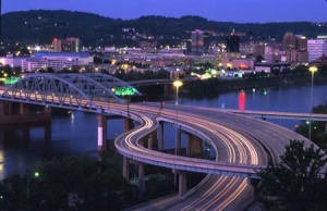
The important thing is that we are walkin’! Keep up the good work!
Hey! Good News! We made it to Columbus Ohio!
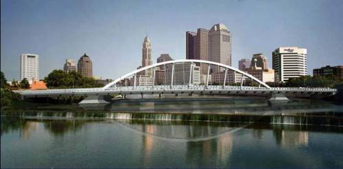
and Frankfort Kentucky!
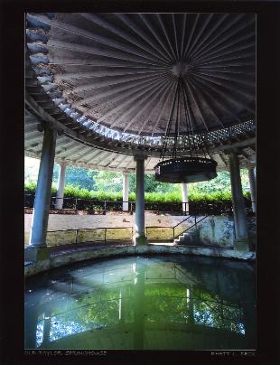
Next up is Nashville Tennessee! We just need one hundred and twenty five more miles to get there!
And we got a large donation today so here she is……..Nashville Tennessee!
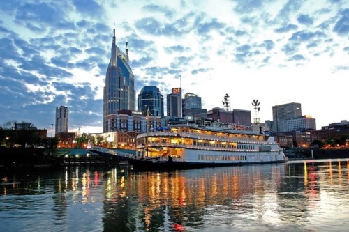 Isn’t she beautiful!
Her nickname is the music city. According to Wikipedia …Nashville is the capital of the U.S. state of Tennessee and the county seat of Davidson County.[5] It is the second most populous city in the state after Memphis. It is located on the Cumberland River in Davidson County, in the north-central part of the state. The city is a major hub for the health care, music, publishing, banking and transportation industries.
The next state we have been able to go through is Indianapolis Indiana!
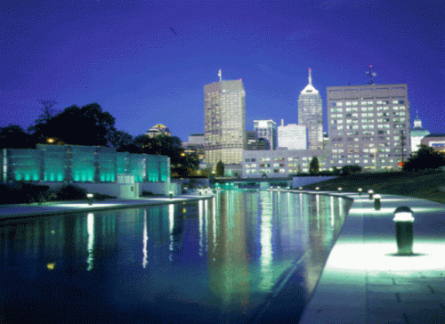 Wow! Maybe we can really walk to some of these places some day. I hope so… they are beautiful.
I had an opportunity to visit Indianapolis. I went to visit my wonderful and wacky friend Sarah when she went to IU. It was a very short visit though so I didn’t see as much as I would have liked.
Another assist from Wikipedia…
Indianapolis is the capital of the U.S. state of Indiana, and the county seat of Marion County, Indiana. The United States Census estimated the city’s population, excluding the included towns, at 798,382 in 2008.[1] It is Indiana’s largest city and is the 14th largest city in the U.S., the third largest city in the Midwest (behind Chicago and Detroit), the second most populous state capital (behind Phoenix, Arizona), and the largest state capital east of the Mississippi River. It is one of two state capitals that share their names with their states (The other is Oklahoma City).
Gee, if everyone in Indianapolis donated one mile we would be more than three fourths closer to our goal!
Next state is Lansing Michigan!
 As you can tell I like pictures with water in it….oh well…I hope you do too.
Lansing is the capital city of the U.S. state of Michigan, and the state’s sixth largest city.
The area that is now Lansing was originally surveyed in 1825 in what was then dense forest. There would be no roads to this area for decades to come.[7]
In the winter of 1835 and early 1836, two brothers from New York plotted the area now known as REO Town just south of downtown Lansing and named it “Biddle City.” All of this land lay in a floodplain and was underwater during the majority of the year. Regardless, the brothers went back to New York, specifically Lansing, New York, to sell plots for the town that did not exist. They told the residents of Lansing, New York that this new “city” had an area of 65 blocks, contained a church and also a public and academic square. A group of 16 men bought plots in the nonexistent city and upon reaching the area later that year found they had been scammed. Many in the group too disappointed to stay ended up settling around what is now Metropolitan Lansing. Those who stayed quickly renamed the area “Lansing Township” in honor of their home village in New York.[7]
Well on we go to Madison Wisconsin!
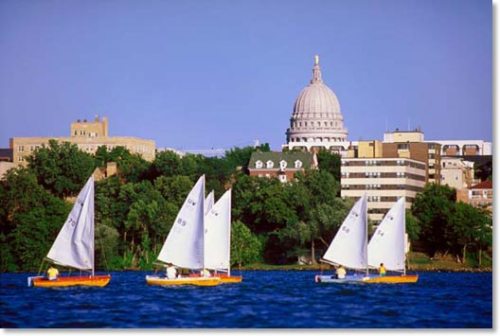 Yay!!! I also love boats! Yes, water and boats! I basically grew up on one the first ten years of my life, living in Rhode Island….thus the love of water and boats.
Some more info. about Madison from Wikipedia…
Madison was created in 1836 when former federal judge James Duane Doty purchased over a thousand acres (4 km²) of swamp and forest land on the isthmus between Lakes Mendota and Monona within the Four Lakes region, with the intention of building a city on the site. The Wisconsin Territory had been created earlier that year and the territorial legislature had convened in Belmont, Wisconsin. Doty named the city Madison for James Madison, the 4th President of the U.S. who had died on June 28, 1836 and he named the streets for the other signers of the U.S. Constitution.
Moving on to Springfield Illinois!
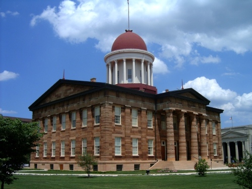 This would be the old capitol building.
And this would be the new capitol building…
And from the Illinois official site…Springfield became the Illinois state capital in 1837 with the help of a young lawyer and politician named Abraham Lincoln. He lived in the city until he left to become the 16th President of the United States, in 1861. From that moment on, the city’s history and future have been inexorably tied to this most famous and beloved American citizen.
And still moving on to Jefferson City Missouri!
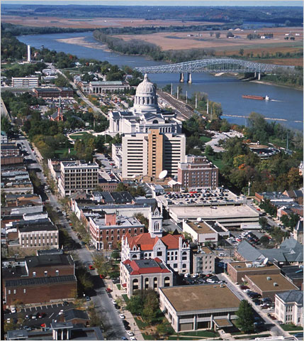 Jefferson City was named after Thomas Jefferson, the third president of the United States of America.
In pre-Columbian times, this region was home of an ancient people known only as the Mound Builders. By the time European settlers began arriving, the Mound Builders had vanished into history. The contemporary indigenous peoples were called the Osage Indians. When the Missouri Territory was organized in 1812, St. Louis was the seat of government. St. Charles next served as the capital.
In the middle of the state, Jefferson City was chosen as the new capital in 1821. The village was first called Lohman’s Landing. When the legislature decided to relocate there, they proposed the name “Missouriopolis” but later settled on Jefferson City.[4] For years the village was little more than a trading post located in the wilderness about midway between St. Louis and Kansas City. In 1826 the Missouri legislature first met here and in 1839 the settlement was incorporated as a city.
Another picture of Missouri…
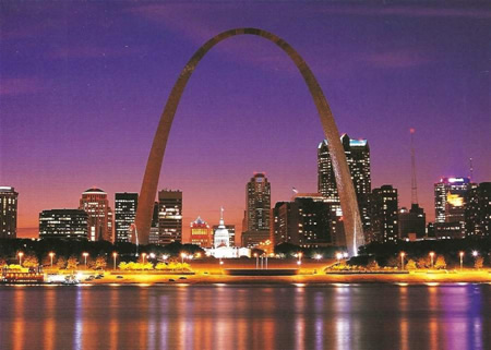
Next state up is Topeka Kansas….isn’t she beautiful!
 Glad we’re not walking in Kansas during tornado season…
Topeka (Kansa: Tó Ppí Kˀé) is the capital city of the U.S. state of Kansas and the county seat of Shawnee County. It is situated along the Kansas River in the central part of Shawnee County, located in northeast Kansas, in the Central United States.
Three ships of the US Navy have been named USS Topeka in honor of the city.
Topeka means “to dig good potatoes” in the languages of the Kansa and the Ioway. The potato referred to is the prairie potato, Psoralea esculenta, a perennial herb which is an important food for many Native Americans. As a placename, Topeka was first recorded in 1826 as the Kansa name for what is now called the Kansas River. Topeka’s founders chose the name in 1855 because it “was novel, of Indian origin and euphonious of sound.”[3][4] The city, laid out in 1854, was one of the Free-State towns founded by Eastern antislavery men immediately after the passage of the Kansas-Nebraska Bill. In 1857, Topeka was chartered as a city.
Next stop Lincoln Nebraska!!!!
Well we made it!!!! Here is the capital building…
and here is the skyline of the city at night….
Lincoln started out as the village of Lancaster, which was founded in 1856, and became the county seat of the newly created Lancaster County in 1859. The capital of Nebraska Territory had been Omaha since the creation of the territory in 1854; however, most of the territory’s population lived south of the Platte River. After much of the territory south of the Platte considered annexation to Kansas, the legislature voted to move the capital south of the river and as far west as possible. The village of Lancaster was chosen, in part due to the salt flats and marshes.
However, Omaha interests attempted to derail the move by having Lancaster renamed after the recently assassinated President Abraham Lincoln.[citation needed] At the time, many of the people south of the river had been sympathetic towards the Confederate cause and it was assumed that the legislature would not pass the measure if the future capital was named after Lincoln. The ploy did not work, as Lancaster was renamed Lincoln and became the state capital upon Nebraska’s admission to the Union on March 1, 1867.
The city was recently named one of the healthiest cities in the United States as of 2008.
I really hope we get to go to some of these places. I would like there to be a real walk to these places but …one step at a time…one step at a time!!!
We are moving right along!!!
Anyone can donate miles and every kind of exercise counts! So email your friends and family. It doesn’t cost anything but sweat equity…ha ha ha..but I believe it is very powerful to help others heal.
Many thanks to those who have donated miles!!!
I hope y’all are also thinking positively about healing, speaking positive words of healing and/or praying for people to be healed also. That is also an important part of the journey we are on. I believe that the more positive things we are sending out to others, the better off we all will be.
The next state we made it to is Des Moines Iowa…..
 Is this a beautiful capitol building or what? And that is not the only beautiful sight…a little farther north of Des Moines and this is what you could see….
 We can create some beautiful things but does it really compare?
It was incorporated on September 22, 1851, as Fort Des Moines which was shortened to “Des Moines” in 1857.[4] It is named after the Des Moines River, which may have been adapted from the French Rivière des Moines, literally meaning “River of the Monks.”
Des Moines is an important city in United States presidential politics as the capital of Iowa, which is home to the Iowa caucuses. The Iowa caucuses have been the first major electoral event in nominating the President of the United States since 1972. Hence, many presidential candidates set up campaign headquarters in Des Moines. A 2007 article in The New York Times stated “if you have any desire to witness presidential candidates in the most close-up and intimate of settings, there is arguably no better place to go than Des Moines.”
The next state we have made it to is St. Paul Minnesota….Yay!!!
The city lies mostly on the north bank of the Mississippi River, downstream of the river’s confluence with the Minnesota River, and adjoins Minneapolis, the state’s largest city. Known as the “Twin Cities“, these two cities form the core of Minneapolis-Saint Paul, the sixteenth largest metropolitan area in the United States.
The settlement originally began at present-day Lambert’s Landing but was referred to as Pig’s Eye, when Pierre “Pig’s Eye” Parrant established a popular tavern there. When Fr. Lucien Galtier, the first Catholic pastor of the region, established the Log Chapel of St. Paul (shortly thereafter to become the first location of the Cathedral of St. Paul), he made it known that the settlement was now to be called by that name, as “St. Paul as applied to a town or city was well appropriated, this monosyllable is short, sounds good, it is understood by all Christian denominations…
 Well this is a lovely harbor. Let’s see if I can find a pic of the capitol building…
Very nice….there are many faces of St. Paul Minnesota..
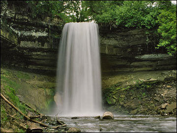 Maybe we can take a hike to this lovely waterfall someday
Below is The Landmark Center downtown St. Paul Minnesota. It is used for many different things; currently there is a fine arts high school there along with many offices, and it is also used for weddings and other special events. In the winter there’s an outdoor ice rink next door! It’s a beautiful building that is definitely a “Landmark” of St. Paul!
Many thanks to Maggie for this information!
Well enough loitering around St. Paul Minnesota….we must move on ….
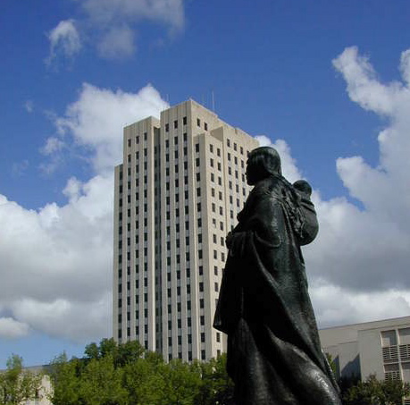
the next state is Bismarck North Dakota!
North Dakota is a Midwestern state in the United States known as the, “Peace Garden State.” North Dakota became the 39th state in 1889. The Missouri River flows through the western part of the state and forms Lake Sakakawea behind the Garrison Dam. The state capital is Bismarck and the largest city in the state is Fargo. See picture below…
And the next state capitol we are going to is Pierre South Dakota…
 And now a little about Pierre South Dakota….
The plain’s level terrain provided easy access to the Missouri River and the rolling hills formed a natural border to the west, which made the plain an ideal site for settlement.
American Indian tribes were the first to recognize the advantages of the Fort Pierre plain. The Arikara and bands of the Dakota, Lakota and Nakota were among the tribes that settled, traded, or passed through the plain. European exploration into the area began with the Verendrye brothers in 1743. Lewis and Clark followed in 1804 and 1806, and trader Manuel Lisa visited the Fort Pierre plain in 1811.
European explorers and fur traders realized the natural benefits the area had to offer and soon established fur trading forts across the plain.
When General George Custer and the Seventh Cavalry discovered gold in the Black Hills in 1874, the City of Fort Pierre began to grow because of the gold rush.
And the next state capitol we are visiting is Cheyenne Wyoming…
Did anyone think we would get this far?
 I like to find more than one picture of the states if I can so here is another…
On July 4, 1867, General Grenville M. Dodge and his survey crew platted the site now known as Cheyenne in Dakota Territory (later Wyoming Territory). This site was chosen as the point at which the Union Pacific Railroad crossed Crow Creek, a tributary of the South Platte River. The city was not named by Dodge, as his memoirs state, but rather by friends who accompanied him to the area Dodge called “Crow Creek Crossing.” It was named for the Native American Cheyenne nation (“Shay-an”), one of the most famous and prominent Great Plains tribes closely allied with the Arapaho.
There were many from a hundred miles around who felt the construction of the Union Pacific Railroad through the area would bring them prosperity. By the time the first track was built into Cheyenne November 13, 1867, over four thousand people had migrated into the new city. Because Cheyenne sprang up like magic, according to newspaper editors visiting from the East, it became known as “Magic City of the Plains”
Now on we go….to Denver Colorado!
The City and County of Denver is the capital and the most populous city of the state of Colorado, in the United States. Denver is a consolidated city-county located in the South Platte River Valley on the High Plains just east of the Front Range of the Rocky Mountains. The Denver downtown district is located immediately east of the confluence of Cherry Creek with the South Platte River, approximately 15 miles (24 km) east of the foothills of the Rocky Mountains. Denver is nicknamed the Mile-High City because its official elevation is exactly one mile, or 5,280 feet (1,609 m) above sea level.[2] The 105th meridian west of Greenwich passes through Union Station, making it the reference point for the Mountain Time Zone.
Denver City was founded in November 1858 as a mining town during the Pikes Peak Gold Rush in western Kansas Territory.[11] That summer, a group of gold prospectors from Lawrence, Kansas, arrived and established Montana City on the banks of the South Platte River. This was the first settlement in what was later to become the city of Denver.
On November 22, 1858, General William Larimer, a land speculator from eastern Kansas, placed cottonwood logs to stake a claim on the hill overlooking the confluence of the South Platte River and Cherry Creek, across the creek from the existing mining settlement of Auraria. Larimer named the town site Denver City to curry favor with Kansas Territorial Governor James W. Denver.
The location was accessible to existing trails and was across the South Platte River from the site of seasonal encampments of the Cheyenne and Arapaho. The site of these first towns is now the site of Confluence Park in downtown Denver. Larimer, along with associates in the St. Charles City Land Company, sold parcels in the town to merchants and miners, with the intention of creating a major city that would cater to new emigrants. Denver City was a frontier town, with an economy based on servicing local miners with gambling, saloons, livestock and goods trading. In the early years, land parcels were often traded for grubstakes or gambled away by miners in Auraria.
Here is a picture of the state capitol building…
Hey!!!!! The next city we are going to is Salt Lake City Utah…..Yay!…
Take a look at this gorgeous shot!….
If anyone has pictures of any of the capitol buildings or cities of the united states please let me know via email. Any of the ones we have already been to would be appreciated sooner rather than later but I’ll take any that people would like to donate.
I don’t know if any of the pictures I have used are copywritten.
I would love to make sure that I have permission to use the pictures I have on my blog.
Thanks!
For a little bit of info. about Denver …
The city was founded in 1847 as Great Salt Lake City by a group of Mormon pioneers led by their prophet, Brigham Young, who fled hostility and violence in the Midwestern United States.
Before Mormon settlement, the Shoshone, Ute, and Paiute had dwelt in the Salt Lake Valley for thousands of years. At the time of the founding of Salt Lake City the valley was within the territory of the Northwestern Shoshone; however, occupation was seasonal, near streams emptying from Canyons into the Salt Lake Valley.
Mining booms and the construction of the first transcontinental railroad initially brought economic growth, and the city was nicknamed the Crossroads of the West. Salt Lake City has since developed a strong outdoor recreation tourist industry based primarily on skiing. Salt Lake City was host to the 2002 Winter Olympics and is the industrial banking center of the United States.
The First Transcontinental Railroad was completed in 1869 at Promontory Summit on the north side of the Great Salt Lake. It gained statehood in 1896, when Salt Lake City became the state capital.
Here is a picture of the state capitol…
The statue of the Native American here is of Massasoit. This statue honors a Massachusetts Indian leader created by Utah-born artist Cyrus Dallin.
Sooooooooooooooooo anyway…..on we go to the next state……..
Helena Montana!
Wow!
And here below is “The Gates of the Mountains”…
The Gates of the Rocky Mountains were named by Lewis and Clark. Captain Lewis wrote on July 19, 1805,…
“this evening we entered much the most remarkable clifts that we have yet seen. these clifts rise from the waters edge on either side perpendicularly to the hight of 1200 feet. … the river appears to have forced its way through this immense body of solid rock for the distance of 5-3/4 Miles … I called it the gates of the rocky mountains.”
Moving along….here below is the state capitol building…
Seeing as how we are visiting all the state capitols I thought it would be great idea to show you pictures of them…
Helena is the capital city of the U.S. state of Montana and the county seat of Lewis and Clark County.
The town was originally named “Crabtown“, after John Crab, one of the “Four Georgians”. As other miners arrived and the town expanded, the name was changed to a more appealing title. After many suggestions, John Sommerville suggested the name of his home town, St. Helena, Minnesota, but the pronunciation (Hel-EE-na) did not suit the miners, who preferred the pronunciation of Helena, Arkansas, HELL-en-a. Dropping “Saint” from the name as unnecessary, the new name Helena was adopted (defeating the name “Tomah” by only two votes).
The townsite was first surveyed in 1865 by Captain John Wood. However, many of the original streets followed the chaotic paths of the miners, going around claims and following the winding stream. As a result, few city blocks are consistent in size, rather they have an irregular variety of shapes and sizes.
In 1870, Henry D. Washburn, having been appointed Surveyor General of Montana in 1869, organized the Washburn-Langford-Doane Expedition in Helena to explore the regions that would become Yellowstone National Park. Mount Washburn, located within the park, is named for him.
Yay! Montana…I know it is only a little snippet about the capitol of this great state.
I hope there will be those who know her better who will comment about the state. Send pictures and stories of this state.
I haven’t been there myself but I have met a man who lives there. He was nick named him “Montana” by friends in NH because he lives there. He served as a medic in Vietnam and is a wonderful matter of fact man. I hope to get a chance to meet him in his home state.
I live in New Hampshire but I would one day love to have a chance to see “The Gates of the Mountains” and the beautiful state of Montana.
But we are not staying in Montana for a long time we are gonna continue walking and exercising our way on to the state of Idaho…Boise Idaho to be exact.
You can dance your way there…you can walk or run, skip or jog, climb or swim. Just get up and get going!!!
The area was called Boise long before establishment of Fort Boise. Accounts differ, however, about the origin of the name. One version credits Capt. B.L.E. Bonneville of the U.S. Army as its source. After trekking for weeks through dry and rough terrain, his exploration party reached an overlook with a view of the Boise River Valley. The place where they stood is called Bonneville Point, located on the Oregon Trail east of the city. According to the story, a French-speaking guide, overwhelmed by the sight of the verdant river, yelled “Les bois! Les bois!” (“The woods! The woods!”) — and the name stuck. An apocryphal version of this story mis-attributes this guide as being part of the Lewis and Clark Expedition.
But the name may actually derive from earlier mountain men, who named the river that flows through it. In the 1820s, French Canadian fur trappers set trap lines in the vicinity. Set in a high desert area, the tree-lined valley of the Boise River became a distinct landmark. They called this “La rivière boisée”, which means “the wooded river.” [4]
The original Fort Boise was 40 miles (64 km) west near Parma, down the Boise River near its confluence with the Snake River at the Oregon border. This defense was erected by the Hudson’s Bay Company in the 1830s. It was abandoned in the 1850s, but massacres along the Oregon Trail prompted the U.S. Army to re-establish a fort in the area in 1863 during the U.S. Civil War. The new location was selected because it was near the intersection of the Oregon Trail with a major road connecting the Boise Basin (Idaho City) and the Owyhee (Silver City) mining areas, both of which were booming at the time. During the mid-1860s, Idaho City was the largest city in the Northwest, and as a staging area, Fort Boise grew rapidly; Boise was incorporated as a city in 1864.
Here is another view of Boise…Swan Falls Dam on the snake river…
I am sure there are many other beautiful pictures out there that ya’ll would love to send me…..just drop me a line and send ’em on over!
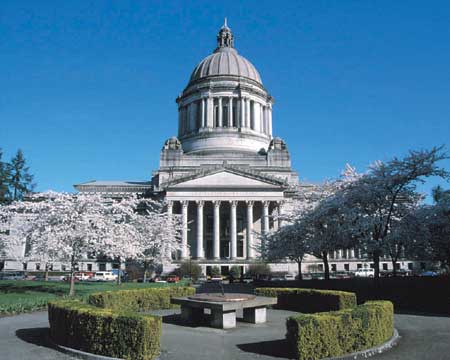
And stilllllllllll Mooooooooooooving on to Olympia Washington!
I am sooooooooooooo grateful to all those who have donated miles!!!
Thank You!!!!! Thank you!!!!! Thank you!!!!!
And to those who haven’t yet or haven’t in a while……just send me an email or comment on the blog and get them too me!!!!!
So we can get on to Hawaii and back to have some fun in Tijuana Mexico before we head into Carson City Nevada.
I can even post videos if anyone has any of those they would like to send. Maybe you have hiked or climbed or swam in any of these places. I can add the videos to those states.
Well here we go now with a picture of Olympia Washington…
But I do prefer this view of the capitol…
And you all should know why by now…..yes…..it’s the boats!!!!
—————————————————————————————
This image came from the following website…
commons.wikimedia.org/wiki/File:Olympia-Washi…
I am not sure if this is a working link or not but the photo is usable if I provide a link to the website. So I have tried to provide a link.
—————————————————————————————
I love boats and being on the water, in the water, at the beach, looking at the water anywhere. I especially love the ocean though. I will be looking for some cool pictures of the California coastline!
I will have to bug my nephew for some. He is living there right now and just had me send him a lot of family pics for a family calendar. He actually has been cross country as well more than a couple times so he might be able to give me pics of other states too.
I will ask.
Until then….I will use the random pics I am able to find on the internet….
When this gets big though I will have to be a lot more careful to get releases for pics and hopefully take a lot of my own from places I actually get to visit.
First stop for actual pics I take will be from Chicago Illinois…..2010 Susan Komen 3Day 60 mile walk!!!!!!! Whoooooooooooooooooooohooooooooooooooo!
Unless we make it all the way back to New Hampshire before August 2010. I have lots of pics of New Hampshire!!!
Anyway here is the other pic I found of Olympia Washington…
And here is some info. about Olympia Washington….
The site of Olympia was home to Lushootseed-speaking peoples for thousands of years, including Squaxin, Nisqually, Puyallup, Chehalis, Suquamish, and Duwamish. The first recorded visit by Europeans was in 1792 when Peter Puget and a crew from the British Vancouver Expedition charted the site.
In the 1840s, Edmund Sylvester and Levi Smith jointly claimed the land that now comprises downtown Olympia. In 1851, the U.S. Congress established the Customs District of Puget Sound for Washington Territory and Olympia became the home of the customs house. Its population being steadily expanded from Oregon Trail immigrants, in 1853 the town settled on the name Olympia, at the suggestion of local resident Colonel Isaac N. Ebey,[4] due to its view of the Olympic Mountains to the northwest. The area began to be served by a small fleet of steamboats known as the Puget Sound Mosquito Fleet.
In 1896, Olympia became the home of the Olympia Brewing Company, which brewed Olympia Beer until 2003.
A 1949 earthquake damaged many historic buildings beyond repair and they were demolished. Parts of the city also suffered damage from earthquake tremors in 1965 and the 2001 Nisqually earthquake.
In 1967, the state legislature approved the creation of The Evergreen State College in Olympia. Because of the college’s presence, Olympia has become a hub for artists and musicians, and was recently named one of the best college towns in the nation for its vibrant downtown and access to outdoor activities.
And still further moving on… lately I have been doing more walking, biking and working on weight machines at the Keene New Hampshire YMCA. I kind of grew up at the Y in Rhode Island.
We had one pretty close to home growing up in Barrington Rhode Island. My friends and I went to swim at the pool in the summer and I learned to swim by taking swimming lessons there. To this day I recall those great memories every time I smell chlorine. It reminds me of the pool. I love to swim. You probably would have never thought of chlorine as a comforting smell but for me it is, as long as it’s not too strong a smell and there’s a pool nearby. Oooooh baby!
I’m sorry, we were moving on weren’t we.
We are moving on to a country actually ….. Victoria British Columbia!!!!
I couldn’t resist….if you look at a map it is so close to Washington and right on the way to Juneau Alaska….plus we had enough miles to get there but it takes almost two thousand miles to get to Juneau…so here we are and ….
here it is from the very mouth of the …..
VICTORIA, British Columbia, Canada Travel Guide
– the Gem of the Pacific North-West, the Garden City of Canada, is the preferred destination of millions of international visitors each year. Many British Columbians also call Victoria home. One little known fact is that Victoria receives 65% more sunshine than Vancouver. Said another way, Vancouver receives 65% more rain than Victoria.

Photo Credit: Vern Faulkner/Esquimalt News
Passing history Against the magnificent backdrop of the Olympic Mountains, Canadian submarine HMCS Victoria slows to let a sailing vessel pass. The submarine returned to Esquimalt Harbour Friday, after several days of tests and exercises around Vancouver Island.
Victoria offers a unique blend of old-world British charm and 21st Century comfort. In 1862 Victoria was described as: “The largest town north of San Francisco; population 4,000 to 5,000, or about four-fifths of the entire population of the colony. Four years ago it was a trading post of the Hudson Bay Company, and contained about 250 people.”
Whether you wander the vibrant gardens and parks, stroll the lively Harbour or break-water, visit the museums and stately homes, go to a spa or rest in the sun as you watch the world go by, Victoria has something for everyone.

Well that was a lovely little peak to wet your appetite. I want to go to visit now!
But wait there’s more….

Wow! Is that something!
Victoria is the capital city of British Columbia, Canada. Located on the southern tip of Vancouver Island, Victoria is a major tourism destination seeing more than 3.65 million visitors a year who inject more than one billion dollars into the local economy.
Prior to the arrival of the Captain James Cook in the late 1700s, the Victoria area was home to several communities of Coast Salish peoples, including the Songhees. The Spanish and British took up the exploration of the northwest coast of North America beginning with the visits of Juan Perez in 1774 and of Captain James Cook in 1778 although the Victoria area of the Strait of Juan de Fuca was not penetrated until 1790. Spanish sailors visited Esquimalt Harbour (within the modern Capital Regional District) in 1790, 1791, and 1792.
In 1841 James Douglas was charged with the duty of setting up a trading post on the southern tip of Vancouver Island, upon the recommendation by Sir George Simpson that a second line of forts be built in case Fort Vancouver and the other lower Columbia River valley forts fell into American hands (see Oregon boundary dispute). Charged with this task, Douglas founded Fort Victoria, on the site of present-day Victoria, British Columbia. This proved beneficial when in 1846 the Oregon Treaty was signed, extending the British North America/United States border along the 49th parallel from the Rockies to the Strait of Georgia.
Erected in 1843 as a Hudson’s Bay Company trading post on a site originally called Camosun (the native word was “camosack”, meaning “rush of water”) known briefly as “Forts Albert”, the settlement was later christened Fort Victoria, in honour of Queen Victoria. The Songhees established a village across the harbour from the fort.
There are so many beautiful pictures of this place…
I also have to include some pics of Saskatchewan Canada as well because one of my wonderful ministry friends lives there and has donated miles to this cause…
Yay!!!!! I received another large donation of miles and collected miles and we were able to get to Juneau Alaska!!!! Yay!!!!!!!
One of my friends grew up in Kodiak Alaska.
Here is a picture of Kodiak…


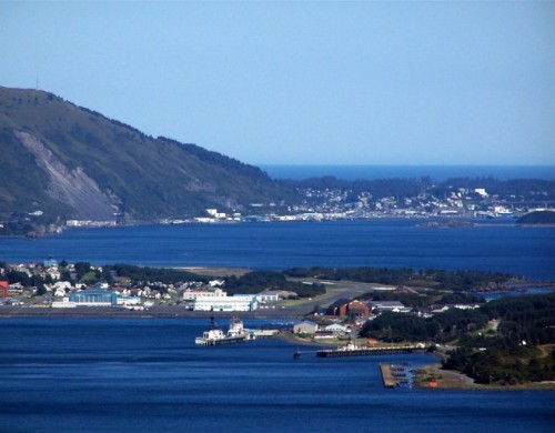 Now….moving on…..we are going to trek back to the lower 48….
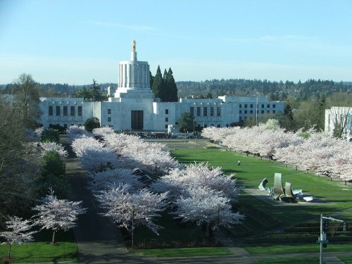
On to Salem Oregon!!! Below is a picture of the Capitol building
And this other picture below is of the Oregon Coast… if you continue west from Salem Oregon…More specifically it is called Cascade Head….what a beautiful coastline! If we were not just going to the state capitols I would walk the extra 264 miles or so to the coast.
 I’m sorry that we can’t stay here at the beach for long……we have to move on…….next stop Sacramento California!
Alas….I have not called ahead to see if we could meet with Mr. Schwarzenegger…so sorry….we will just have to take a look at the state capitol and see if we can visit with him another time.
It is only another 87 miles to San Francisco….they host a Susan Komen 3day event there….I will try that one after I get a few more 3days under my belt and have built up my calves and quads to be able to do hills…
I will also have to throw in some pics of Cali. beaches….they are very beautiful…
and here is a pic of Laguna Beach which is in southern Cali…
Gotta love sunsets…..aren’t they beautiful!!!
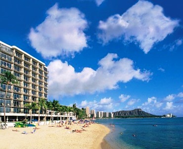
Well enough languishing on the beach in southern California and on to Honolulu Hawaii!
I am very grateful to everyone who has been diligent to get to aerobics class, the gym, hiking and clearing trails, playing soccer, ice skating, walking, aquasize, climbing, ice hockey, softball ice hockey, and every other kind of exercise that has been donated for us to be able to get this far in our virtual walk!!!
THANK YOU!!!!!!!!! THANK YOU!!!!!!!! THANK YOU!!!!!!!!
Well here we go to Hawaii….
 Well I knew that this building would look different…
and of course what do the beaches look like in Honolulu?…
and this…
And that is as far as we have gotten as of 2/12/10. Next on our list I thought we would stop by Tijuana Mexico on the way back to the main land just for fun!
So we have virtually walked approx. 11,000 miles so far. Bear in mind that I have not leaked word out to the press. I need to replace my pictures and facts from the internet with pictures and facts from people who are willing to donate them to the cause of “Exercising One Million Miles for world wellness”!
We have a little less than 2,000 miles to travel to get to Tijuana from Honolulu….so lets keep up the exercise and encourage others we know to start exercising too and donating miles for world wellness!
We can do it! As my friend always says…..hup….hup…hup! Instead of always relying on driving somewhere to work out we text each other and encourage each other to work out at home too….I’m up…I’m up…hup…hup!
Many thanks to the In Shape program and participants, family, friends, new friends, Walmart employees, Pizzario Unos waitresses, all my “Pink Wings”team mates and Lady of America ladies!!!
Yay!!!
When I added up miles on my birthday which was way back in November of this year……geesh….sorry it has been so long…….we have made it to Tijuana Mexico and all the rest of the capitols of the United States and are starting on the capitols of the countries of the world!
Please bear with me as I am looking up these pictures and information on the internet. So it may take me a while to get all the pictures and some info. of the rest of the United States.
If it is possible for anyone to send any pictures of any of these states please send them to jenniferireland1117@gmail.com. It might help me get this done a little faster.
I am not a teacher just someone like you wanting to encourage people to exercise and believe that healing is possible and is happening!
So ….here is what I was able to find for pics of Tijuana Mexico…

I will have to ask my parents to send me some pictures of when I went when I was younger. I am hoping they have some good ones.
Ok….moving right along to Carson City Nevada…
Well I am having some technical difficulties with uploading pictures at the moment…will have to get back to updating soon.
Don’t forget to exercise!








We are excited to log on the blog. We are weighing in at 21+16+15+15+276=343
Hey everybody!
I have some miles to add also 6 miles so we have a total of 349!
Yay!
I will update where we will walk with those miles soon!
Hey! We have 100 more miles to add to our total!
So now we have a total of 449!
And we have 108 to travel in virtual miles to other capitals in other states!!!!
Will be updating those tomorrow!
Staples has small laminated maps with the US on one side and the world on the other if you want to follow the trail on a map and see how far we are getting across the US.
I will be walking the NAMI (National Alliance for Mental Illness) walk this Sunday and will be asking the walkers there to donate miles!
I would also like to say that I have been hearing about a lot of healings happening lately!
I will give more details about that tomorrow also!
Feel free to let us know about any healing that you know has happened!
going back to july I will add 91 miles of hiking and running.
I also have 20 miles to add from the NAMI walk and walking today with three others from In Shape!
Thank you so much for your donation of miles!!!
211 miles will be added to the total that we have so far of 449+211=660
We had 8 miles left over after arriving in Albany NY to go toward the next state capital so that means that we have 219 miles to help get to Harrisburg Pennsylvania.
Just 11 more miles and we will be able to get to Harrisburg!
Then we will need 287 more to get to Charlestown West Virginia.
Well you guys!!!! I still have to show my math work but I can add another 28 miles from a great family that I know and another 82 miles from a combination of a dance class at MoCo Arts wellness center and 14 more miles from Lady of America gym aerobics classes I attended. There is also another 7 miles a friend of mine walked this week.
I will make sure to go over the math more carefully but I have worked the figures once and know that we have been able to make it to Harrisburg Pennsylvania and Charlestown West Virginia!!!!!!
Yay!!!
Hey what a great blog! We will be back to add more later. oh happy day we are moving and walking around the world. Pollliann
Hi, if you are still wondering about the building in the wintertime picture of St. Paul, MN, it is The Landmark Center downtown. It is used for many different things; currently there is a fine arts high school there along with many offices, and it is also used for weddings and other special events. In the winter there’s an outdoor ice rink next door! It’s a beautiful building that is definitely a “Landmark” of St. Paul!
Dear Maggie,
Thank you so much for this information. It is such a beautiful building and it is so nice to know more about it.
I had an opportunity to visit Italy in 1986 to see if I could study my second semester abroad at the Angelicum in Rome. It didn’t end up working out….but I did have a wonderful time visiting and took lots of pictures of everything that looked interesting including a pyramid in Rome believe it or not. But didn’t have time or money for any kind of tour guide so don’t know what a lot of the picrtures are of. I do know that one is of the Trevi fountain….and me standing in it. But so many others I don’t know.
Sorry about the time lapse in responding. Lots going on….It really takes a lot of time to keep in shape. My husband and I also helped our eldest move out, celebrated our youngests eighteenth birthday, and many other things.
It is great to finally get some comments to the blog.
Thanks again!!!
Jen I.
The unidentified St. Paul building is the Landmark Center. It is the former United States Federal Court House and Post Office.
Thank you so much for the very valuable information!!!
I am very grateful for your response!!!
Jen I.
Very nice tour, just so you know the picture you say is Montpellier, France is actually the village of Vernazza in Ligurian region in northwest Italy, a very beautiful area.
Thank you so much for your correction. I definitely want to be accurate with this so I will have to do some better research of Montpelier France and change the picture.
I am hoping to submit a grant to be able to do more work on updating the blog and doing more with it.
Thank you again for your help….
Please send positive thoughts, words, prayers for a way to advance this.
Are you serious? I’m so glad to have found this on google. This is worthy to share to everyone I know.
Dear Angela,
Thank you. I am working on updating the blog. It is slower going than I would like.
I am contacting each state office of tourism so I am sure I have accurate information about each state. I also need to add up more miles. We have actually made it to all the states of the U.S. and are working on country capitals now. We have over 16,000 miles donated. Yay!
I just recently did an interview with Dartmouth Hitchcock Cheshire Medical Center about it. You should be able to see that on u-tube in the next week or so. Dartmouth Hitchcock Cheshire Medical Center Champion Moment March 3oth.
Thank you so much for your encouragement!
Hope you are doing well!
Jen I.